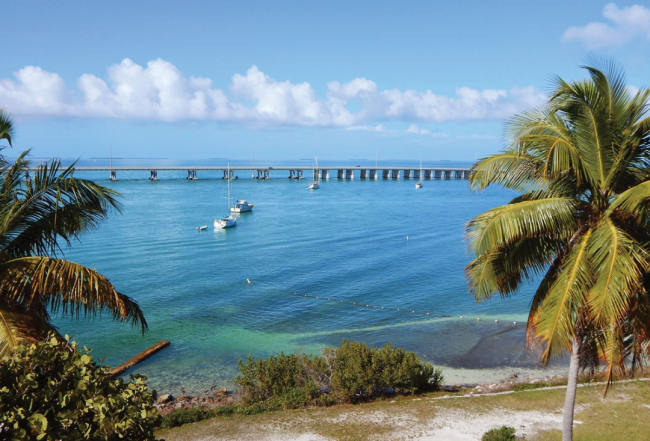
Extending in a sweeping southwesterly curve from Miami and the mainland, the Florida Keys offer a cruising experience unlike any other waterway area. In many ways the Keys resemble the islands of the Bahamas except for the main highway and 42 bridges (a total of 18.94 miles of bridges) that tie them together.
Geologically the Florida Keys are mainly the exposed parts of coral reefs and weathered limestones. Some of the islands have been exposed for so long that sand has built up around them creating barrier islands, while other smaller islands remain as coral atolls. With outstanding natural and artificial underwater reefs, fishermen, snorkelers and divers have found a submarine paradise flanking the southeastern shores of the Keys.

Beyond the Keys' northwestern shores lies Florida Bay: a fisherman's heaven and also the gateway to the Everglades National Park. This natural area offers its own unique beauty.
Mariners need to be particularly aware of the wind conditions while navigating the Keys. The region's shallow waters make "wind tide" a serious problem. This is a phenomenon in which strong winds push water from one side of an enclosed basin to another. It is of particular concern on the bay side where operating depths can be a low as 5 feet MLW. In strong northwest winds dockside depths at the marinas can be increased by as much as 1.5 feet, while dockside depths can be reduced by 1.5 feet in strong southeasterly winds.
Inside or Outside Route?
Cruisers continuing west from Miami to the Florida Keys have two options:
- Inside Route: Stay on the ICW following Biscayne Bay and the sounds to their western ends then pass under the Card Sound Road Bridge and on into Florida Bay following the chain of the Keys along the bay side.
- Outside Route: Enter the Atlantic Ocean from Biscayne Bay at either Cape Florida Channel or Angelfish Creek then follow the Hawk Channel westward around Key Largo and continue on along the ocean side of the Keys.

With either choice, cruisers can switch from one route to the other at Channel Five or Moser Channel, on each side of Marathon and west from Marathon.
One "must have" when making your decision is the online Waterway Explorer, a free interactive web application for navigation. Specific marina and anchorage information can be found as well as details on bridges and navigation alerts.
This choice is not a simple one. Each skipper must evaluate conditions and make the appropriate decision. If taking the inside (ICW) route, slow down and keep a close watch on the depth sounder as depth changes of up the 1.5 feet are common in strong winds in Florida Bay and elsewhere in the Keys.
Note that these changes are greater than tidal effects and must be taken into consideration in planning a passage along the ICW on the Inside Route. Obviously in depths of 4 to 5 feet MLW a reduction of 1.5 feet is significant.
Along the bay side stretch of the ICW from Tavernier Creek to Shell Key, you can expect some of the shallowest conditions you will see anywhere on the ICW system with charted depths of 4.5 to 5 feet MLW.

To make matters worse, the bottom conditions along this stretch are charted as "rocky." For boats that draw over 5 feet we recommend the Outside (Hawk Channel) Route (or "keep to the ocean side" as the locals might say).
Wind strength and direction are other critical considerations. Prevailing winds in the Keys generally have an easterly component. In the summer a southerly component is added, whereas a northerly component is more common in the winter. (Note this is based on probability and is not a prediction.)
If winds have either an easterly or southerly component at more than 10 to 15 knots expect choppy conditions in the Hawk Channel (Outside Route). In northwest to north-northeast winds the Outside Route will be the more comfortable route as the westerly curve of the keys will provide more protection.
On the Inside (ICW) Route, cruisers can expect better protection, at least in the closed sounds and basins initially followed by the ICW until things open up north of the Matecumbe Keys. Here the fetch increases and cruisers will experience chop in north to southwest winds.
Chop is of particular concern on the inside route as effective water depths will be reduced by the boat's bobbing motion. In east through south-southwest winds the Inside Route is well protected by the unbroken chain of the Florida Keys.
The final consideration, which is well known by seasoned Florida Keys mariners, is that the unbroken chain of the Florida Keys blocks the movement of water as well as waves. The water in the large expanse of the Florida Bay is landlocked on the north, east and south. Strong winds from any of these directions will push the waters of the shallow bay from one side to another creating "wind tide" conditions.
Some cruisers will opt to visit both "sides" of the Keys via a roundtrip. Be aware that depth and clearance restrictions will make some harbors and marinas inaccessible, particularly to sailboats. Careful planning of anchorages and provisioning stops can influence your routing decisions.
We've outlined both the Inside & Outside routes for navigating the Florida Keys in depth in Chapter 10 of our Southern Waterway Guide covering everything from cruising conditions, navigating channels, to bridge schedules and Goin' Ashores.


