The Hudson River Valley is emerging as a haven for city refugees who want the culture without the noise and crowds of the city. Many of the riverside towns are being transformed from industrial centers to New York City suburbs. On the upper river, creeks (both natural and dredged) make protected layovers.
Cruising Conditions
Cruising the Hudson River is generally straightforward. Aids to navigation are plentiful, mid-channel depths range from 15 feet to 175 feet and marinas and hospitable yacht clubs are numerous north of Manhattan. Overnight berths should be selected for maximum protection from the river's natural chop and the wake from passing recreational and commercial traffic. On the upper river, creeks (both natural and dredged) can make for good, protected layover spots.
NOTE: It should be noted that many of the marine facilities that list or advertise themselves as "clubs" are perfectly acceptable stopovers that are not limited to members.
The route upriver is easily navigated for 91 miles to Kingston but extensive middle grounds and steep-to shoals must be given a wide berth after this point. In the lower Hudson River, rocky shoals are common off the channel and departure from the marked route must be made with caution and local knowledge. Above Kingston the bottom is mostly sandy with some mud and grass and few rocks.
The few hazards consist mainly of debris–both floating and submerged––and fish traps (in the spring). In the Albany/Troy area, just as in New York Harbor, drifting debris calls for an endless watch, particularly at a tide change and during the spring run-off.
Commercial traffic can be heavy at times with barge activity and should be given full right-of-way, especially in periods of poor visibility. It is generally best to communicate with any commercial vessels on VHF Channel 13.
Tidal Currents
Tidal water extends to Troy, where the mean tidal range varies from 3 to 5 feet and currents can be strong (an average of 1.5 knots as far north as Albany). When you are northbound, you will be going away from the tidal current change so you can hold a fair current longer than you will when southbound. The 153-mile Hudson estuary has two high and two low tides in 24 hours. With the rise and fall come changes in the direction of the flow. A rising tide is accompanied by a flood current flowing north towards Troy, and a falling tide by an ebb current flowing seaward. For this passage, skippers should have a copy of the latest tide and tidal current tables aboard. These can be downloaded from NOAA Tides & Currents.
In the tidal portion of the Hudson River, select your marina slip with great care. You will want to avoid slips that are in the cross current as maneuvering into or out of the slip may be difficult. You will also want to ensure that the marina is equipped with proper fendering to minimize damage to your boat.
Weather
The wind usually blows up or down the Hudson River, but near shore it tends to sweep toward the banks. Watch for summer squalls with sudden winds of up to 30 knots. Your only warning might be black clouds along the high west-bank bluffs. Get to the weather side of the river whenever you see indications of rough conditions ahead.
Navigation
Charts might not accurately show some privately maintained markers and some markers have been discontinued, while others might not have been replaced after winter ice.
We do not recommend that you head upriver on the Hudson River without the necessary charts. Be sure to download into your navigation system the necessary Hudson River charts. Only a limited number of marinas carry charts of the river. One marina that often carries the river charts is Liberty Landing Marina in Jersey City (201-985-8000). Contact them before you leave New York Harbor or access electronic charts. Also consult the Local Notice to Mariners and Waterway Explorer for alerts and updates.


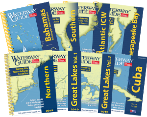
- 4,000 Marinas
- Thousands of anchorages
- Updated Charts
- Mile-by-Mile Navigation
- Highlighted Alerts & Cautions
- Full-Color Aerial Photographs
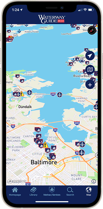
The Waterway Guide App Makes it easy to leave reviews, use our explorer, and view waterway guide materials all on the go!