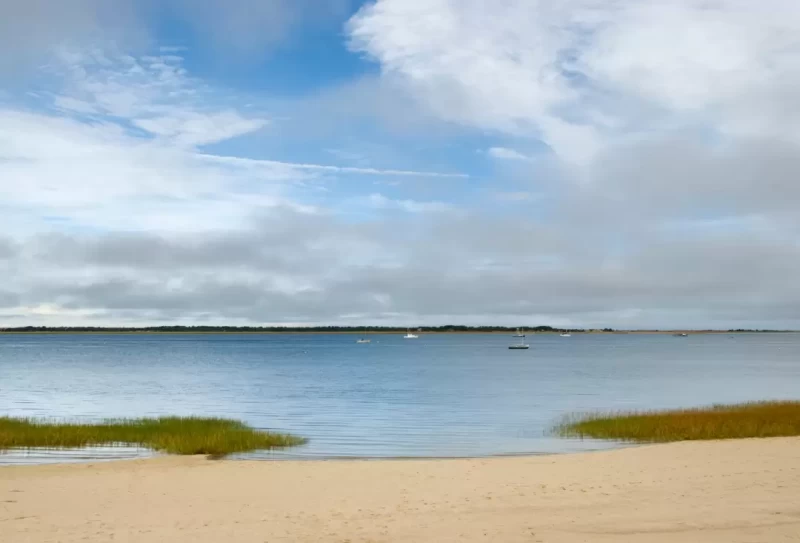
The cold waters north and east of Cape Cod are the birthplace of much of America's maritime heritage. Every harbor and almost every ledge carries a piece of American history or a legend of the sea. Cruising these waters gives the modern-day sailor a strong feeling of sea tradition.
The fastest traditional sailing ships the world has ever known sailed out of these ports including the great clipper ships Flying Cloud, Sovereign of the Seas and Lightning, among others. Often considered the most seaworthy and able sailing vessels ever built, the huge Gloucester fishing schooners made their fame and fortune fishing the Grand Banks in the dead of winter. They were designed and built along the river banks near Cape Ann.
Cruising Conditions
Cape Cod is shaped like a great sandy arm–the upper arm extending easterly 31 miles from the mainland, the forearm heading 25 miles northward and then the fist angling 7 miles back west. Most boats make the leisurely cruise up the coast to explore the historical ports from Plymouth to Boston, Marblehead, Salem and Gloucester and then on to Portsmouth, Kittery and the beginning of the Down East coast.
For others, the eastern end of Cape Cod Canal is the jumping-off point for a short offshore run to Gloucester on Cape Ann then another run for Portland Harbor's large navigational buoy (which replaced an old lightship), from which all of Casco Bay, the Mid-Coast and Penobscot Bay are easily accessible. Others bide a while in Provincetown before the long offshore run directly to Isle au Haut or Mount Desert Island and Acadia National Park. These routes take you through Stellwagen Bank, a prolific whale-watching area.
A voyage in these waters warrants considerable preparation and flexibility. A journey from one harbor to another will probably involve a stretch of open water so skipper, crew and vessel must be prepared for the challenge. The water is markedly colder than the water below the Cape and the vessel's water supply and hull will feel much cooler as a result. Most locals and cruising boats that tackle this area have a heating source to warm up the cabin on cool mornings. Swimming is a more venturesome exercise than in more southern climes, and an accidental swim must be considered a matter of life or death because hypothermia is a risk, even in the summer.
Fog can be a factor on any day (especially in June and July), although it might burn off by mid-morning and leave a clear, warm day. A wind from a southerly or easterly direction may bring in unannounced fog at any time. The skipper making his way through "a pea-souper" for the first time is likely to take his navigational skills more seriously thereafter. Fog is usually accompanied by calm waters and light winds but beware the "smoky sou'wester." During this condition a stiff breeze builds up rough seas that break on the ledges and obscure the sounds of bells and gongs. And if the fog remains heavy, obscuring islands, buoys and other boats, it is advisable to stay put in the harbor.
The rise and fall of the tide is an important factor in each day's plans, especially as you voyage farther east. Tides of 10 to 13 feet are not unusual in these parts. Keep in mind that many harbors are available to even the deepest-draft vessels at high tide, but that same tide can put you high and dry where hours earlier there was plenty of water underneath the keel. Conversely, anchoring for low-tide depths will be dangerously short scope at high water.
Furthermore, that ledge at the mouth of the harbor that is clearly visible as you enter at low water might be submerged and dangerous when you leave. Tidal currents are less predictable than they are below Cape Cod and may unexpectedly flow even after predicted high and low tides.

Navigation
The charted Pollack Rip Channel leads from Nantucket Sound and across the Monomoy Shoal to the ship channel off Cape Cod. The east entrance to Pollock Rip Channel continues to have severe shoaling east of flashing red "4." When transiting the channel, Mariners are urged to transit at their slowest safe speed and proceed with extreme caution.
The passage through or around the crooked elbow of Cape Cod may not win you an earring like crossing the equator, but it marks a major step for most coastal cruising plans and the entrance into an endless mariner's paradise. To cruise "above the Cape" is to venture farther away from civilization and the recreational boating crowds. Self-sufficiency and competent seamanship become more important.
The water is colder, weather changes quickly, the fog is thicker and the ledges are crueler in the swells of the open ocean. The sea here can be less forgiving to carelessness and inexperience than any other waters we cover. There are no barrier islands offering an "inside passage" and protection from the sweep of the sea, except in small cross-cuts between rivers and deep in the bigger bays.
Anchoring & Mooring
In many, if not most harbors mentioned in this guide, designated Special Anchorage Areas are available in which vessels of less than 20 meters in length are not required to show anchor lights, day shapes or sound signals. Anchoring within a Special Anchorage Area does not require permission but permission for the use of mooring balls, within or outside of a Special Anchorage Area is required.
In spite of the proliferation of mooring balls, it is often possible to still find places to anchor, both within and outside of the Special Anchorage Areas, keeping an appropriate distance from mooring balls, channels, docks, boatyards and marinas (not to mention other boats).
Also, as previously mentioned, "yacht club" here doesn't necessarily mean private, as it does farther south. Many private clubs welcome transients and not necessarily from reciprocal yacht clubs. Call ahead for details.
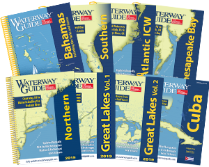
- 4,000 Marinas
- Thousands of anchorages
- Updated Charts
- Mile-by-Mile Navigation
- Highlighted Alerts & Cautions
- Full-Color Aerial Photographs
The Waterway Guide App Makes it easy to leave reviews, use our explorer, and view waterway guide materials all on the go!