1 – MM 238.2 Browns Inlet ATON R60 is off station due to dredging which is underway
Do not automatically honor any of the ATONs at Browns Inlet. Several have been moved to allow dredging. R60 has been moved into shoal water. The shallowest part of Browns Inlet has not yet been dredged. Follow the Bob423 track for best water.

The noon to 1:00 pm openings on weekdays are on demand. Vessels that can clear the 15 foot height of the new bridge can transit at any time. Openings outside the times mentioned will be on top of the hour from 7:00 am to 7:00 pm and on demand from 7:00 pm to 7:00 am.
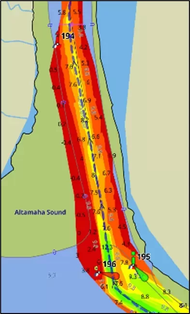
3 – MM 280.2: Groundings reported at Mason Inlet due to shoaling in the channel to 2.3 MLLW
Mason Inlet has once again shoaled as in the past. Follow the Bob423 track for 6.6 MLLW. There's less than 2.3 MLLW in the NOAA channel. TowBoatUS has been very busy here the last couple of weeks, don't be part of their fun. The satellite view shows the close approach required by the docks.

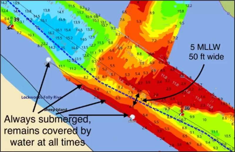
4 – MM 320 Multiple groundings at Lockwoods Folly Northern Approach
Captain reported a grounding on 12/9 when he strayed too far to port when going north and ran into the submerged barrier noted on charts (covered by water at all times). He hit the barrier and the underwater pilings at both ends. The good water path is only 50 ft wide, you cannot stray on either side. One side has the barrier, the other has the shoal. Follow the Bob423 track for best water 6 MLLW as of 12/10/2024 but there's little leeway to stray off the track.

5 – MM 655 Little Mud River has shoaled to 3.3 MLLW with many spots of 4 to 5 MLLW.
The southern part of Little Mud River has a spot of 3.3 MLLW with many areas of 4 to 5 MLLW throughout the entire passage. You will need tide to get through. The bottom is soupy mud so even if you see 0.0 on your sounder, you may not notice a drag at first.

6 – MM 1021.8 Flagler Memorial, Royal Park, and Southern Blvd Bridges on temporary schedules
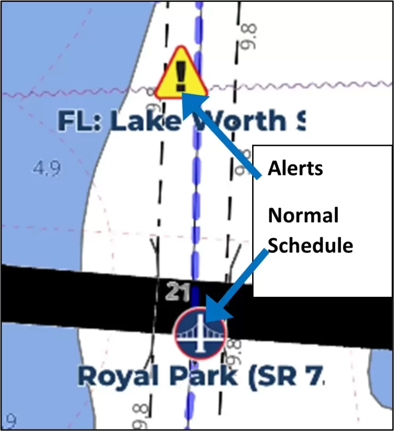
Some mariners have accessed only the bridge icon for a bridge's schedule, which only gives the normal operating schedule, and were confused when they encountered a different schedule when approaching the bridge.
The bridges mentioned above have temporary schedules due to construction that are detailed in the Alerts next to the bridge in Aqua Map and on the Waterway Guide site. When planning for a day's journey, be sure to check for Alerts by bridges – any deviations from the normal schedule will be detailed there (see photo). Links for the three bridges are below:
- Flagler Memorial Bridge
- Royal Park Bridge
- Southern Blvd Bridge

Use Waterway Guide's Navigation Alerts to plan your trip, adjusting timing for the tide you need. Follow the Bob423 tracks in Aqua Map to ensure you get the maximum depth possible. The color-coded depth charts are from USACE surveys in Aqua Map. The areas mentioned in this Bulletin are only the recent changes, not a complete picture of all shoaling. Additional resources are available in the Waterway Guide digital publication 2024 ICW Cruising Guide and at Bob423 Guides.


