The southern migration on the ICW is coming to a close as are the Bob423 AICW Bulletins. For those still going south, here's a list of problem areas we've covered in the past few weeks that are still catching unwary boaters.
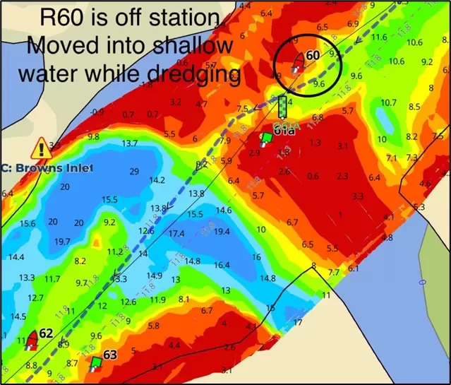
1 – MM 238.2: Browns Inlet is still being dredged. Expect the ATONs to be off station and call the dredge for directions on passage.

2 - MM 240.7: The Onslow Bridge construction closures are due to end 12/20/2024 at 5:00 pm but may be extended.
Keep abreast of the Onslow Bridge status with the Waterway Guide link.
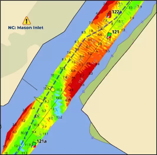
3 – MM 280.2: Groundings reported at Mason Inlet due to shoaling to 2.3 MLLW. Follow the Bob423 track. There are no plans for dredging. 
4 – MM 293.7: At Carolina Beach Inlet, you need to avoid R154A by 200 feet, making a wide turn following the Bob423 track. There are no plans for dredging.
5 – MM 320: Lockwoods Folly River at the ICW just before Lockwoods Folly Inlet going south is down to 6 MLLW but only on the Bob423 track. It's very narrow and bordered by a shoal on one side and a barrier on the other side. There are no plans for dredging.
6 - MM 460: Isle of Palms is still the shallowest section of the ICW, bare in the main channel at low tide but 4.5 MLLW on the Bob423 track and 6.7 MLLW on the detour route (red dotted line). There are no plans for dredging. 
7 – 1004.8 Jupiter Inlet US 1 bridge is due to close to marine navigation on 12/20/2024 from 8:00 am to 4:00 pm. Call ahead to be sure of the projected closure.
Use Waterway Guide Navigation Alerts to plan your trip, adjusting timing for the tide you need. Follow the Bob423 tracks in Aqua Map to ensure you get the maximum depth possible. The color-coded depth charts are from USACE surveys in Aqua Map. The areas mentioned in this Bulletin are only the recent changes, not a complete picture of all shoaling. Additional resources are available in the Waterway Guide digital publication 2024 ICW Cruising Guide and at Bob423 Guides.


